TNRD.COM

Add Site
Agriculture
Attractions
ATV's
Auto Dealers
Banking
Bed and Breakfast
Campgrounds
Chambers of Commerce
Classified Ads
Computers
Events
First Nations
Fishing Resorts
Fishing Supplies
Forestry
Fraser Canyon
Gold Rush Trail
Golf
Hockey
Home Improvement
Home Page
Hotels
Maps
Mining
Motorcycles
News
Nicola Valley
Night Clubs
Radio
Ranches
Real Estate
Recreation
Restaurants
River Rafting
Shopping
Sports
Thompson River
Tourism
Traffic
Trucks
Weather
Web Cams

More Categories ...


TNRD Kamloops Region
Google
 
MAPS ...


This page contains an online directory of Satellite, Road, and Topographical Maps for the cities, towns, and villages located in and around the Greater Thompson-Nicola region, or of interest to the region.

Add your web site to our directory.


> Ashcroft satellite map ...
> Ashcroft road map ...
> Ashcroft topographical map ...
> Barriere satellite map ...
> Barriere road map ...
> Barriere topographical map ...
> Blue River satellite map ...
> Blue River road map ...
> Blue River topographical map ...
> Cache Creek satellite map ...
> Cache Creek road map ...
> Cache Creek topographical map ...
> Chase satellite map ...
> Chase road map ...
> Chase topographical map ...
> Clearwater satellite map ...
> Clearwater road map ...
> Clearwater topographical map ...
> Clinton satellite map ...
> Clinton road map ...
> Clinton topographical map ...
> Kamloops satellite map ...
> Kamloops road map ...
> Kamloops topographical map ...
> Lillooet satellite map ...
> Lillooet road map ...
> Lillooet topographical map ...
> Logan Lake satellite map ...
> Logan Lake road map ...
> Logan Lake topographical map ...
> Lytton satellite map ...
> Lytton road map ...
> Lytton topographical map ...
> Merritt satellite map ...
> Merritt road map ...
> Merritt topographical map ...
> Princeton satellite map ...
> Princeton road map ...
> Princeton topographical map ...
> Spences Bridge satellite map ...
> Spences Bridge road map ...
> Spences Bridge topographical map ...
> Sun Peaks satellite map ...
> Sun Peaks road map ...
> Sun Peaks topographical map ...
> Thompson-Nicola Regional District satellite map ...
> Thompson-Nicola Regional District road map ...
> Thompson-Nicola Regional District topo map ...
> Tulameen satellite map ...
> Tulameen road map ...
> Tulameen topographical map ...
> Vancouver satellite map ...
> Vancouver road map ...
> Vancouver topographical map ...
> 100 Mile House satellite map ...
> 100 Mile House road map ...
> 100 Mile House topographical map ...


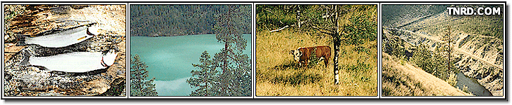
This page contains a directory of Satellite, Road, and Topographical Maps for the cities, towns, and villages located in and around the Greater Thompson-Nicola region, or of interest to the area. For the purposes of this web site, maps from the following regions can be included in this directory; Ashcroft, Barriere, Cache Creek, Chase, Clearwater, Clinton, Kamloops, Lillooet, Logan Lake, Lytton, Merritt, Princeton, 100 Mile House, and the other smaller communities located in and around the Greater Thompson-Nicola regional district. Click here to add your web site to our directory.


Copyright TNRD.com